Vantage Highway fire causes haze, threatens 40 structures

A firefighting airplane takes a run over the Columbia River near Frenchman Coulee early Tuesday afternoon. The fire has burned an estimated 8,000 acres so far and firefighting agencies from across the state have been activated to fight the blaze.
R. HANS MILLER/COLUMBIA BASIN HERALD
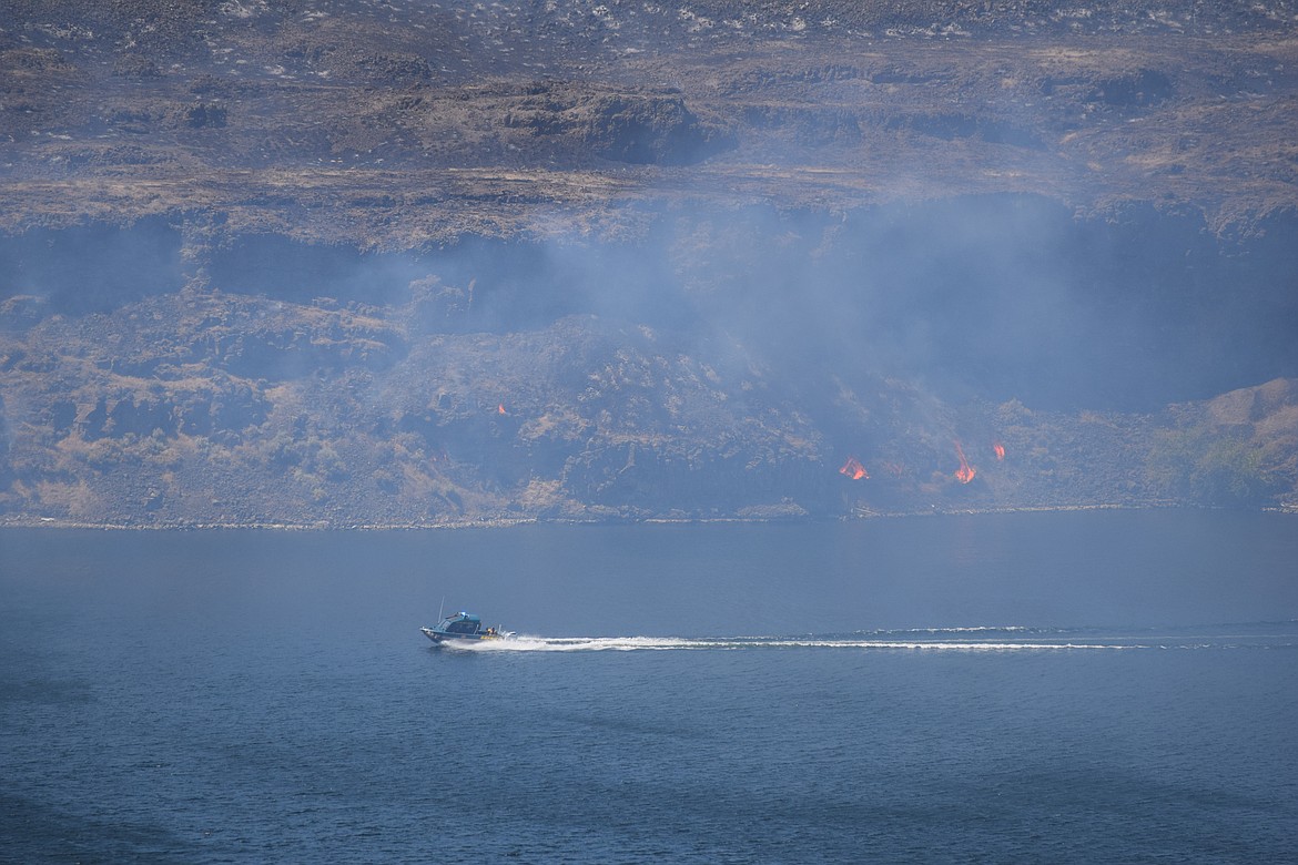
A boat filled with first responders travels down the Columbia River while the Vantage Highway fire burns in the background, near the shore. A wide array of firefighting apparatus are being utilized to fight the fire, including boats, planes, firetrucks and helicopters.
R. HANS MILLER/COLUMBIA BASIN HERALD
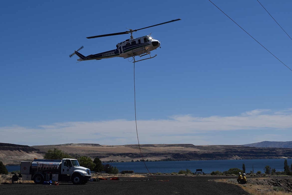
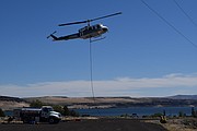
A helicopter takes off from the gravel lot in front of the fire station in Vantage. The line attached to the bottom of the aircraft is attached to a bucket used to pull water from the nearby Columbia River to dump on the fire.
R. HANS MILLER/COLUMBIA BASIN HERALD
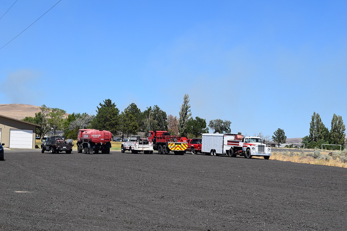
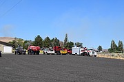
Kittitas County fire apparatus stand ready at the fire station in Vantage, just across the river from Grant County on I-90.
R. HANS MILLER/COLUMBIA BASIN HERALD
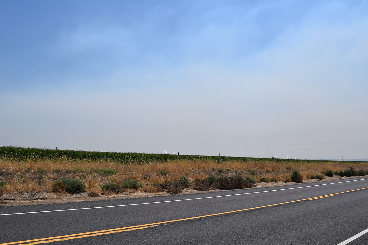
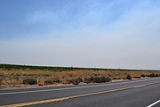
A haze of smoke hovers over fields of crops south of George early Tuesday afternoon. The source of the fire is across the Columbia River and is not expected to jump the river at this time. Officials said the fire is going north along the western edge of the waterway.
R. HANS MILLER/COLUMBIA BASIN HERALD
VANTAGE — A fire is burning on the western side of the Columbia River north of Vantage along the Vantage Highway, leading to the mobilization of state resources to combat the roughly 10,500-acre blaze which threatened about 40 structures Monday.
“We have resources from all across the state because this is a state mobilization fire now,” said Grace DeBusschere, public information officer with Kittitas Fire District 7. “We have (Washington State Department of Natural Resources) ground resources from all across the state. We have local fire district resources and mutual aid partners.”
A small amount of Bureau of Land Management land is also involved in the fire, so BLM staff are on hand to assist as well, along with Department of Fish and Wildlife responders. The state mobilization order, authorized by Washington State Patrol Chief John Batiste at the request of Kittitas County District 4 Fire Chief William Rose, allows those additional resources to respond to the fire, DeBusschere said. Efforts to contain the blaze, which caused a haze of smoke across much of northern Grant and Kittitas counties, include aerial firefighting apparatus such as planes and helicopters. Boats with first responders aboard could also be seen from the Frenchman Coulee area moving around the area impacted by the fire, which she said was spreading in a northerly direction as of Monday at about 2 p.m.
No cause has been identified for the fire at this time; however, it is thought to have started around 1 p.m. Monday. The fire caused the evacuation of the city of Vantage, along I-90 on the east end of the bridge over the Columbia River. No injuries or structure losses have been reported at this time, DeBusshere said.
Shannon Coolidge, who works at the Vintage Chevron station across the street from the fire station in Vantage said the Chevron store had lost power a couple of times since the fire began. An employee at the station had remained behind at the store to ensure firefighters could get snacks and beverages as they worked to contain the fire, she said.
“We wanted to make sure they were all taken care of, you know? Biggest thing was making sure they were all hydrated, so we stayed open later,” Coolidge said.
Coolidge said it was scary when her staff found out that firefighters intended to do a controlled burn - burning the fuel away from near homes so that the homes wouldn’t be threatened - Monday evening. However, she was grateful that the plan seemed to have worked and kept the town safe.
While the fire continues to spread, DeBusschere said it was not expected to cross the river to get into Grant County at the time of the interview. The fire spread across thousands of acres rapidly though and went from 4,800 acres Monday afternoon to roughly 8,000 acres reported Tuesday morning. By 6 p.m., the fire was estimated to have hit 10,500 acres.
“That is from a heat signature map that we looked at (Tuesday) morning,” DeBusschere said. “Since then, we’ve done an aerial recon (to get an) overview of the fire.”
A specialist was analyzing the fire’s path and size to determine a more precise measurement, she added. As of 4:30 p.m., the fire was estimated to be about 10% contained.
DeBusschere said firefighters encourage Washington residents to take precautions to prevent additional fires in the state. Being careful to ensure safety chains for trailers are secured so they won’t cause sparks, not throwing cigarette butts or other hot items out of cars and being careful with fires, in general, are all important she said.
While the haze from the smoke could be seen clearly, DeBusschere did not have any specific information on air quality, the air quality in both Moses Lake and Ephrata were reported to be in the good category Tuesday afternoon by Weather.com and iqair.com. However, DeBusschere said those concerned about air quality to contact their physician if they felt the need.
DeBusschere requested that drone operators in the area not fly their drones near the fire. Detection of drones may cause all air assets fighting the fire to be grounded until all of the drone activity has ceased, she said.
A drone flying in a fire air means that we have to ground every single aerial resource that’s hard at work,” DeBusschere said. “And there is quite a process and assessment that has to happen in order for those aircraft to get back up in the air again. So, do not fly drones in wildfire areas.”
DeBusschere said homeowners concerned about fires can be proactive and remove items leaning against the home and keep yards clear of flammable debris.
Coolidge said she was very grateful for the efforts of the firefighters in the air and on the ground from across the state.
“Thank God for them,” Coolidge said. “It’s not an easy job.”
R. Hans Miller may be reached at [email protected].
EDITOR'S NOTE: This report was updated at 6 p.m. on Aug. 2 with information on expansion of the fire.