Saturday, April 20, 2024
42.0°F

Floodfest celebrates education of the Dry Falls and Sun Lakes

by REBECCA PETTINGILL
Staff Writer | July 28, 2022 1:20 AM

DRY FALLS/SUN LAKES — The annual Ice Age Floodfest was held at the Dry Falls Visitor Center on Saturday and featured the efforts of many to educate the public about the area and its history.

David McWalter, interpretive specialist for the Coulee Corridor and Dry Falls Visitor Center, said he was really pleased with the turnout at this year's Floodfest. He said Floodfest has been held annually for more than a decade but had a couple year hiatus due to COVID-19.

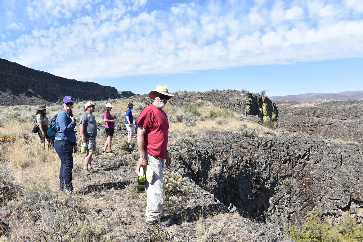
Karl Lillquist, physical geographer at Central Washington University, led the hike at the Sun Lakes-Dry Falls State Park to educate and help people discover the area along with Lorena Medina-Dirksen, Interpretive Specialist for the Dry Falls Visitor Center. Lilquist holds a doctorate in geography from the University of Utah.

“I like supporting public education,” Lillquist said.

The hike started at the Deep Lake parking area where Lillquist gave a small opening presentation with maps to give attendees an understanding of the area and what they would be seeing on the hike. In the presentation, he spoke about how the geography of the area was carved by floods and what evidence was left behind for hikers to see in the area.

About 15 people from all over the state were in attendance for the hike.

From the Deep Lake parking area, the group headed southwest on Deep Lake Road NE. Along the road, hikers walked past basalt columns showing the evidence of the floods and lava flows that created the landscape thousands of years before.

Hikers followed the road until reaching the Caribou Trail Head. The Caribou Trail is a historic stagecoach and cattle trail. From there the group followed the trail, observing the vegetation and wildlife. Discussions were had about the invasive Cheatgrass and natural Rabbitbrush. A Mule Deer was also spotted in the distance.

Veering off the path, hikers were able to see from above the pothole features that scatter the area. McWalter said people from all over the world come to see the potholes.

The group then hiked down to the Deep Lake Trail and made their way back to the Deep Lake parking area.

“For a rich, fulfilling life it's important for people to understand their surroundings whether it's how they came about it (in the) present or how they came about in the past,” said Lillquist. “The story of the ice age floods is a story that really impacts a lot of Central Washington and Eastern Washington, so I think it's important to know something about the landscape you live or play in.”

The 60th Anniversary of the National Natural Landmark for this location includes the gazebo and rock wall at the Dry Falls Visitor Center.

Back at the visitor center, the booths showcased people and organizations with different aspects of the area’s history and features.

McWalter said he hopes to have a full return to normal because 2028 will mark 100 years of Dry Falls operating as a state park and wants to be able to have a big celebration for it.

“The essence of (Floodfest) was basically multiple different agencies and groups bringing together a richness and passion for a place,” said McWalter.

That place being the Coulee Corridor and includes the Ice Age Floods Geology, the Channeled Scablands, Shrub Steppe Ecosystems, Anthropology and Archeology.

Other resources available at the event:

• The Ice Age Floods Institute - from the Lower Grand Coulee Chapter and other chapters from Oregon, Idaho, Montana and Washington.

• Randy Lewis - (Wenatchi/P’Squosa) holds a vast storehouse of the oral tradition that chronicles the stories of Indigenous people living in the Mid-Columbia region. Randy shared the history and stories of Steamboat Rock, Moses Coulee and the Grand Coulee.

• Eric Van Stone, archeologist Colville Nation, demonstrated flint knapping and examples of stone tools.

• Lucy Luevano - Tribal historian for the Colville Nation.

• National Park Service – Interpretive Rangers with a Mobile Interpretive Center showcased the Ice Age Floods National Geologic Trail and Lake Roosevelt National Recreation Area.

• Foster Creek Conservation District had programs on Shrub Steppe ecology, water resources and native vegetation.

• The Bureau of Reclamation brought George S. Jaramillo, historian of the Grand Coulee Power Office with a historical overview of the Columbia Basin Irrigation Project, Grand Coulee Dam, and historical Vista House and rock wall at Dry Falls.

• Archeologist – Mark Amara, Kim Lancaster, and Kellie Green; representing the Cascadia Conservation District, USDA Natural Resources Conservation Service. Their booth highlighted the importance of historical artifacts and tools of the trade.

• Grant County Historians/authors John Kemble and Dan Bolyard were also in attendance. John Kemble, a local historian and explorer, highlighted Dry Falls, Sun Lakes, Steamboat Rock, and the Grand Coulee. Dan Bolyard has been a lifelong Grant County Big Bend area resident and railroad historian.

Rebecca Pettingill may be reached at rpettingill@columbiabasinherald.com.

photo

Rebecca Pettingill/Columbia Basin Herald

Hikers observed potholes that cover the landscape of the Coulee Corridor.

photo

Rebecca Pettingill/Columbia Basin Herald

Karl Lillquist gave attendees of the hike an understanding of the area and what they would be seeing on the hike through maps.

photo

Rebecca Pettingill/Columbia Basin Herald

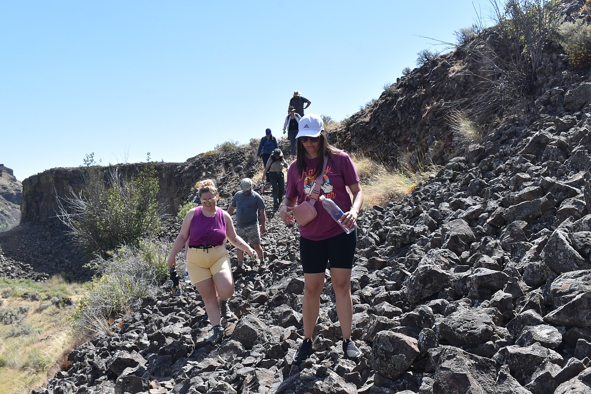
The hike presented a challenging terrain of rocks, cliffs and vegetation.

photo

Rebecca Pettingill/Columbia Basin Herald

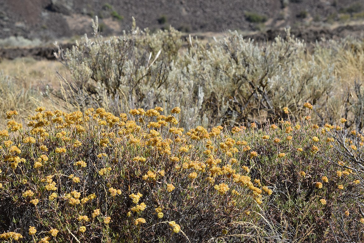
Some of the vegetation of the Coulee corridor.

photo

Rebecca Pettingill/Columbia Basin Herald

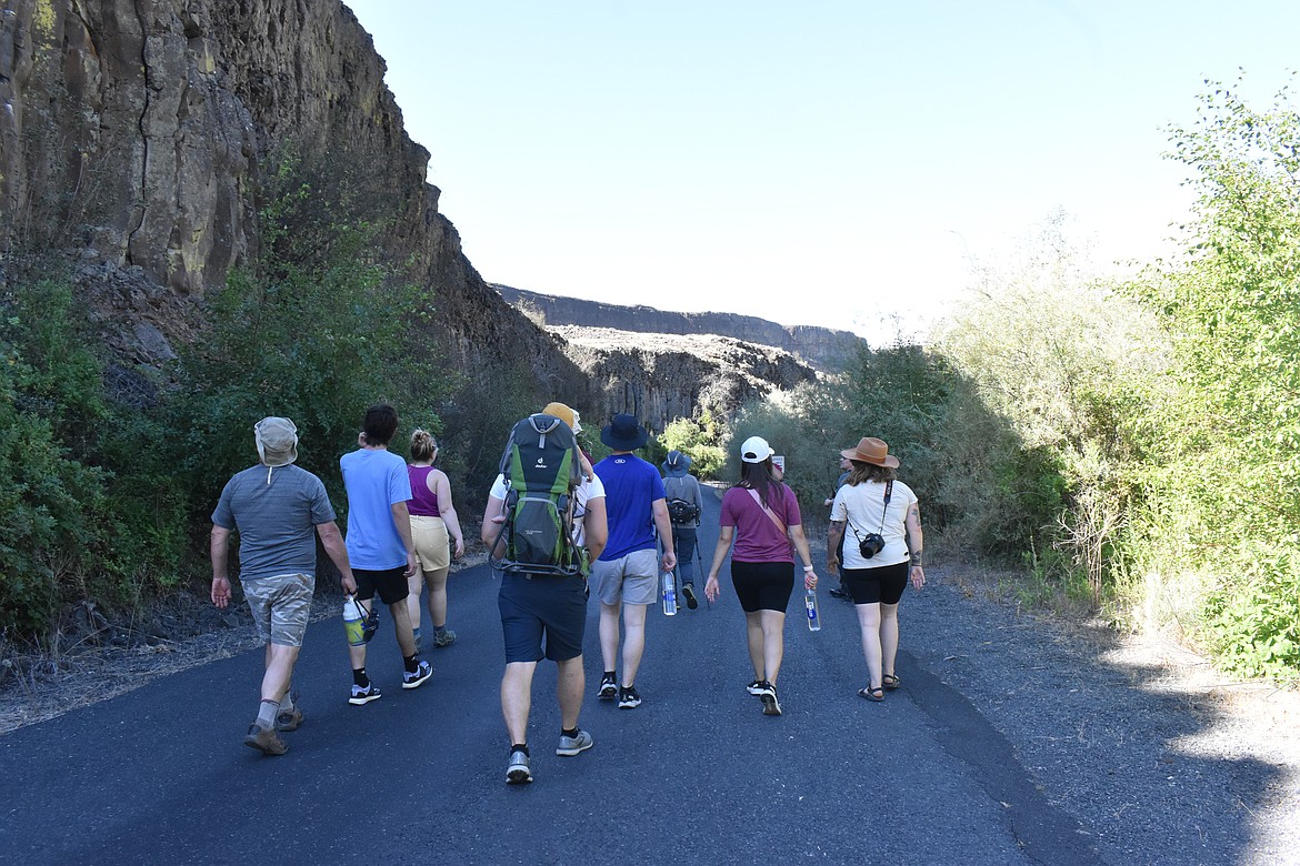
Hikers were able to see firsthand the evidence of the ice age floods and lava flows that carved the area of the Coulee Corridor.

photo

Rebecca Pettingill/Columbia Basin Herald

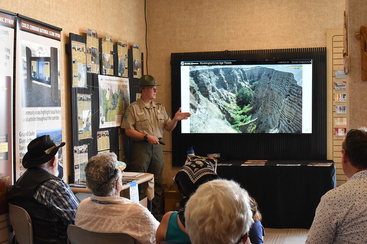
David McWalter, the interpretive specialist for the Coulee Corridor and Dry Falls Visitor Center, gave a presentation at the visitor center chronicling the ice age floods and their impact on the area.

photo

Google Maps

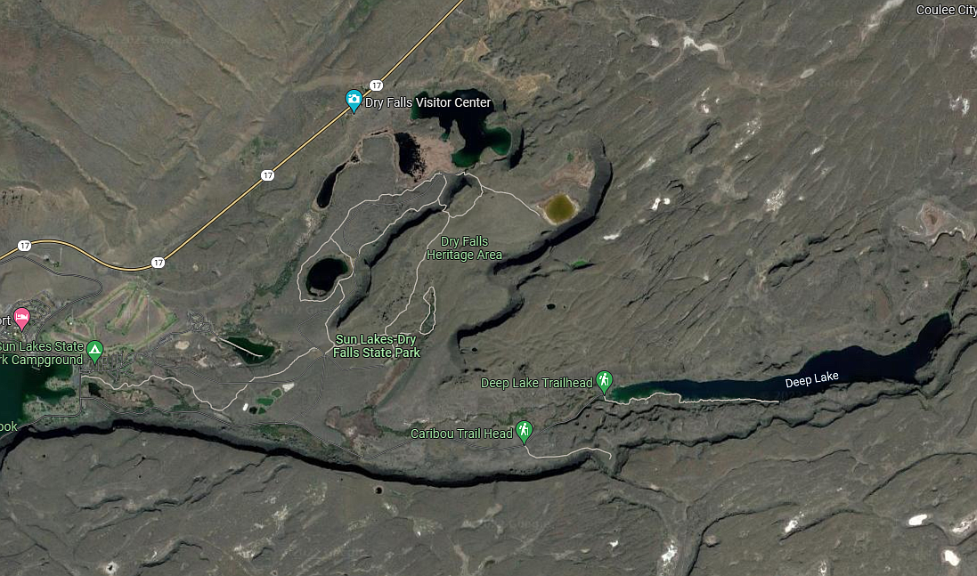
The area of the Dry Falls Visitor Center and Deep Lake.